
The Estonian Transport Administration (TRAM) is a government agency responsible for managing traffic on land, in the air, and on water. They ensure infrastructure maintenance and general safety. Their primary tasks include the construction and maintenance of state roads, management of the traffic register (vehicles and licenses), and supervision across all transport modes. Their goal is to provide a safe, convenient, and smart mobility environment for people and businesses.
Roads API for the Estonian Transport Administration
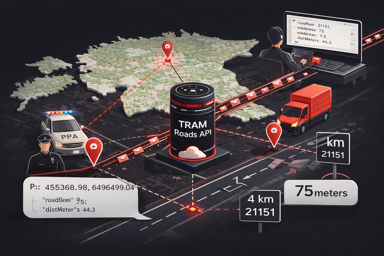
The Roads API instantly converts GPS coordinates into precise, official road addresses. It tells emergency responders and logistics drivers exactly which road number and kilometer marker they are on, ensuring pinpoint accuracy across Estonia’s national network.
About the Client
| Client | Transpordiamet (TRAM) |
| Link to the project | see here |
| Start of the project | November 2025 |
| End of the project | December 2025 |
Client brief
Precision Mapping for a Modern Estonia
In modern logistics and emergency services, a GPS coordinate is just a set of numbers. To the Estonian Transport Administration (TRAM), those numbers must represent a precise location on the national road network. Wenture was tasked with building a high-performance bridge between these two worlds: the TRAM Roads API.
The Challenge: Turning Points into Addresses
National agencies like the Police and Border Guard Board (PPA) generate thousands of coordinate pings every minute. Previously, translating these into official road numbers and kilometer markers (m-addresses) was technically complex and resource-heavy. TRAM needed a solution that was not only pinpoint accurate but also public-facing and capable of handling massive query volumes without slowing down.
The Solution: Mathematical Accuracy Meets Cloud Scale
Wenture engineered a specialized module within the TRAM central API that queries the official Teeregister ArcGIS service in real-time.
Key Features:
- Multi-Format Coordinate Support: Accepts L-EST97 (Estonian national) and WGS84 (GPS) coordinates as input.
- Orthogonal Projection Algorithm: Uses vector projection formulas to find the closest point on the road telje (axis).
- Interpolated M-Address Calculation: Calculates the precise road kilometer marker even when the point falls between data vertices.
- High-Volume Parallel Processing: Built with Java 21 virtual threads to process batch requests of up to 250 points simultaneously.
- Smart Resilience & Caching: Utilizes circuit breakers (Resilience4j) to protect upstream services and Caffeine caching (60-minute TTL) to optimize performance.
Tech Stack:
- Backend: Java 21 and Spring Boot 3.2.
- Integrations: Direct connection to the Estonian Transport Administration’s ArcGIS WFS service (Teeregister “Teed” layer).
The Result: A New Standard for Infrastructure Data
Our solution stands out through:
- Orthogonal Projection: We don’t just find the nearest dot on a map; our algorithm calculates the exact perpendicular projection onto the road, ensuring sub-meter accuracy for every query.
- Smart Resilience: Using Java 21 and modern resilience patterns, we built a system that “fails fast” to protect national infrastructure while using intelligent caching to serve repeat queries instantly.
- Open Access: Following the once-only data principle, we delivered a REST API that is open to the public, allowing any Estonian developer to integrate official road data into their own applications.
The TRAM Roads API now serves as the heartbeat of road-based location services in Estonia. Whether it is a delivery truck verifying its route or an emergency vehicle reporting its position, the data is official, accurate, and delivered in milliseconds. By combining deep mathematical logic with a scalable microservice architecture, Wenture has helped TRAM set a new European benchmark for open infrastructure data.